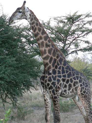
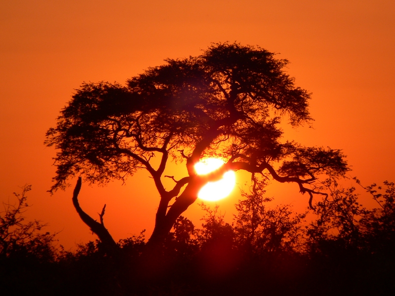
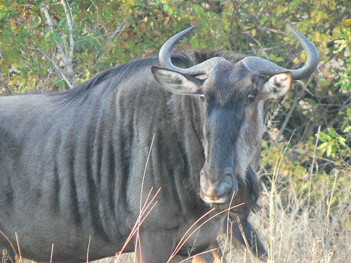
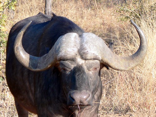
Slide Show of a Few of Our Africa Pictures
Here is a sample of the 2,000+ photos we took on our southern Africa trip:
Tuesday, July 18, 2006
Saturday, July 15, 2006
The LONG, LONG, LONG flight home
We finally arrived home on Friday at 3:30PM Pacific Daylight Time. We left Eagle Island Camp in Botswana over 35 hours ago.
First, there was the Mack Air flight in a six-passenger Cessna from our camp's airstrip to Maun. Then there was the Air Botswana flight to Johannesburg. Yes, there is an Air Botswana, they fly jet aircraft, but they don't have a frequent flyer point program.
Then we had a three hour layover before boarding our SAA flight to NY. The SAA flight was the "killer". It was originally scheduled to fly from J'burg to Dakar, Senegal to refuel and change flight crews before continuing on to NY. But there had been a two day fuel workers' strike in Dakar, so we had to fly to Sal, the airport at the Portugese-owned territory of Cape Verde off the West African coast. There we picked up four SAA flight crews that had been stranded during the strike AND then fly to Dakar where the strike was now over so we could drop off the flight crews.
Altogether we spent 20 hours on the SAA flight, new personal records for flight time for both of us.
Arriving at JFK, we hustled thru customs and hopped over to the jetBlue terminal to catch our flight to Long Beach.
 Of course, we had to make a refueling stop of our own at Papaya King. After wolfing down a couple of good NY hot dogs, we enjoyed the DirecTV on jetBlue where we caught up on the news for the first time in two weeks.
It's amazing. The Middle East is in turmoil, the stock market is doing crazy things, Bush is doing his usual bumbling act of traveling abroad trying to play diplomat so he can avoid his problems at home, and there are brush fires in SoCal. Nothing changes.
Time to catch up on sleep, do laundry, let "the boys" in the house, and start editing the photos and video.
Thursday, July 13, 2006
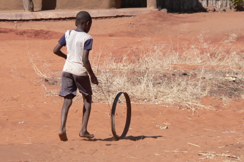
Visiting a Botswana Village
This morning, one of the stops on our game drive was to visit a Botswana village. It was disturbing. Here we have so much and the people we met have so little.
The villagers have a 40% HIV infection rate. There is very little food they can grow because the animals eat most of it.
They get regular visits from a medical team, but children have to go to boarding school in Maun (over 100 miles away).
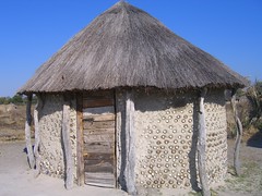 Their homes are huts made from the mud of termite piles and reinforced with layers of used soda cans to prevent the rain from washing away the walls. The roofs are thatch.
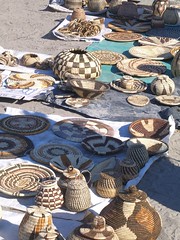 Like we saw in Zambia, the villagers' primary source of income is selling baskets and other handmade souvenirs. They do gorgeous work so we felt good buying multiple items. One Aussie surgeon in our group just decided he needed to hand the children money. It was a good gesture.
This morning, one of the stops on our game drive was to visit a Botswana village. It was disturbing. Here we have so much and the people we met have so little.
The villagers have a 40% HIV infection rate. There is very little food they can grow because the animals eat most of it.
They get regular visits from a medical team, but children have to go to boarding school in Maun (over 100 miles away).
Their homes are huts made from the mud of termite piles and reinforced with layers of used soda cans to prevent the rain from washing away the walls. The roofs are thatch.Like we saw in Zambia, the villagers' primary source of income is selling baskets and other handmade souvenirs. They do gorgeous work so we felt good buying multiple items. One Aussie surgeon in our group just decided he needed to hand the children money. It was a good gesture.
Wednesday, July 12, 2006
Flying Over the Okavango Delta
This afternoon we took a helicopter ride over the Okavango Delta. What a way to see things!
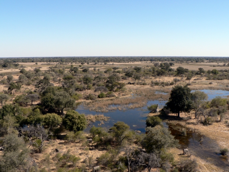 The pilot takes the doors off the helicopter so we can get a better view. Don't worry - we're strapped in pretty well. It's a true E-ticket ride.
After take off, we fly most of the time at 50-100 feet above the ground. That way, we can see the animals quite well as we cross the delta area and several islands.
From the air, you can really see how enormous the Okavango Delta really is. It stretches to the horizon in every direction. No people to be seen anywhere. No roads except the tracks where vehicles go on game drives during the season when the water level in the delta goes down. All transportation is by boat or by air. Yet we know there are other lodges/camps down there as this is a national park.
 Caren shoots away using the digital camera and Jordan is recording video with the camcorder. You can see herds of elephant, giraffe, hippos, impala, and zebra quite easily.
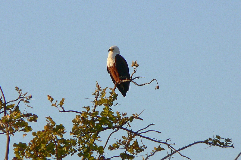
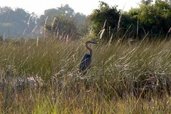
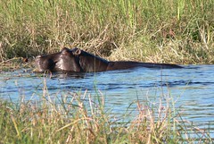
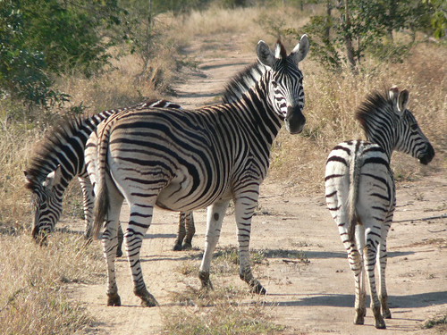
Here are some photos from the helicopter ride and our game drives at Eagle Island Camp:
This afternoon we took a helicopter ride over the Okavango Delta. What a way to see things!
The pilot takes the doors off the helicopter so we can get a better view. Don't worry - we're strapped in pretty well. It's a true E-ticket ride. After take off, we fly most of the time at 50-100 feet above the ground. That way, we can see the animals quite well as we cross the delta area and several islands.
From the air, you can really see how enormous the Okavango Delta really is. It stretches to the horizon in every direction. No people to be seen anywhere. No roads except the tracks where vehicles go on game drives during the season when the water level in the delta goes down. All transportation is by boat or by air. Yet we know there are other lodges/camps down there as this is a national park.
Caren shoots away using the digital camera and Jordan is recording video with the camcorder. You can see herds of elephant, giraffe, hippos, impala, and zebra quite easily.Here are some photos from the helicopter ride and our game drives at Eagle Island Camp:
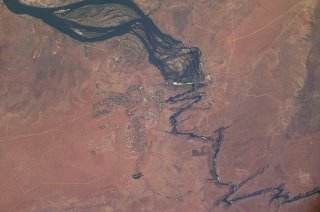
The Okavango Delta in Botswana
Here's a good crossword puzzle word for you - ENDORHEIC. Give up?
It's the name for a watershed from which there is no outflow of water. The Caspian Sea, Dead Sea, Great Salt Lake, and Crater Lake are all endorheic watersheds. So is the Okavango Delta in Botswana where we now are.
It's the world's largest inland delta, flowing into the Kalahari Desert. The number of different types of wildlife is incredible - birds (of all kinds, shapes, and sizes), antelopes, hippos, crocodiles, elephants, buffalo, giraffe, etc.
This is a photographer's paradise. Click on the satellite photo for an enlarged view.

City Boy Freaks Out
This is a story that Caren will tell for years to come....
We are coming out of our tent cabin at Eagle Island Camp about midday, heading to the main building. As we walk along the path, we hear a noise to our left. There, not 10 feet from us, is a bull elephant walking in the camp, heading towards us.
What does Jordan do? He yells "RUN" and starts doing so.
What does Caren do? She whips out her camera and starts to take the elephant's picture.
What does the elephant do? He keeps heading towards us because what he really wants is to get over to the water and start eating some more fresh grass. These elephants eat and crap all day.
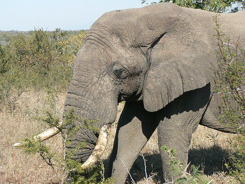
Here is the fellow who stars in this story:
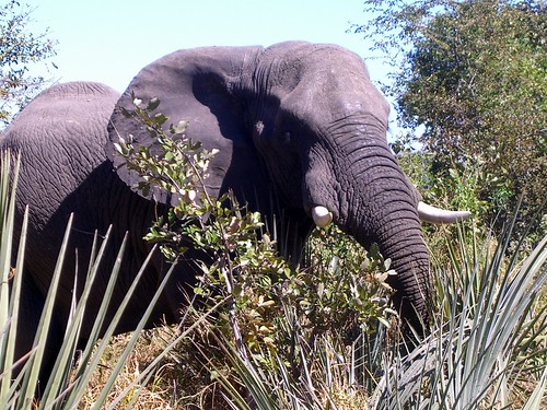
Caren delights in recounting to people how Jordan freaked out when the elephant made his surprise appearance. Obviously, this camp has ZERO fences around it and animals could meander thru the camp whenever they wanted.
This is a story that Caren will tell for years to come....
We are coming out of our tent cabin at Eagle Island Camp about midday, heading to the main building. As we walk along the path, we hear a noise to our left. There, not 10 feet from us, is a bull elephant walking in the camp, heading towards us.
What does Jordan do? He yells "RUN" and starts doing so.
What does Caren do? She whips out her camera and starts to take the elephant's picture.
What does the elephant do? He keeps heading towards us because what he really wants is to get over to the water and start eating some more fresh grass. These elephants eat and crap all day.
Here is the fellow who stars in this story:
Caren delights in recounting to people how Jordan freaked out when the elephant made his surprise appearance. Obviously, this camp has ZERO fences around it and animals could meander thru the camp whenever they wanted.
Tuesday, July 11, 2006
The Dung Walk
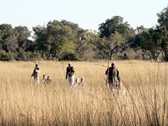
This morning we went on a mokoro ride thru the channels to one of the islands in the delta. A mokoro is like a large canoe, originally carved out of a single tree trunk, but now made out of fiberglass.
Once ashore, we went on what Caren called a "dung walk." We hiked the trails on the island, looking for animal tracks and their droppings. Supposedly, a good tracker can locate the wild animals by examining the dung and foot prints. Caren is putting together a new puzzle she's going to title "Who Did That?" The player has to match the picture of the dung pile with the proper animal. Multiple choice, of course.
Monday, July 10, 2006
Some Photos from Savute Elephant Camp
Here are a few of the photos we took at Savute Elephant Camp. Yes, you can get that close to all the animals. They are NOT tame, but they have no fear of people as long as you don't make any sudden movements or noises.
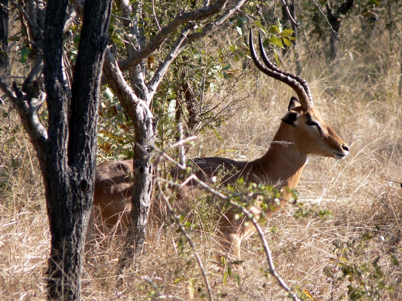 Impala Male
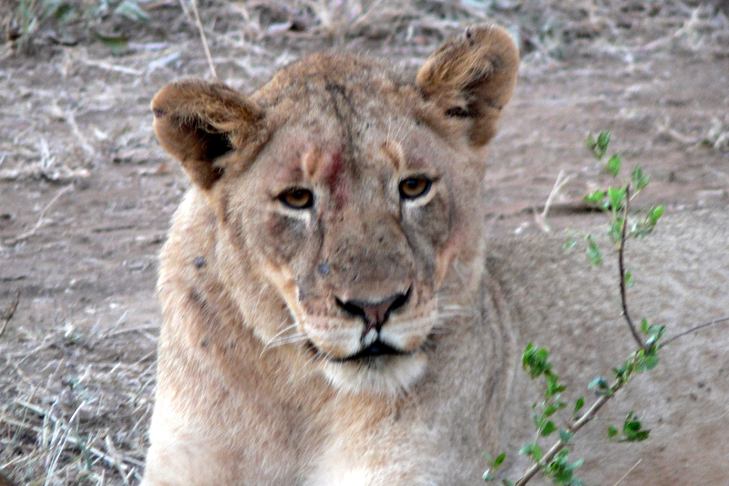
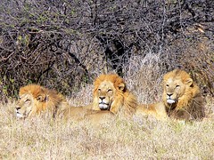 Three male lions - brothers
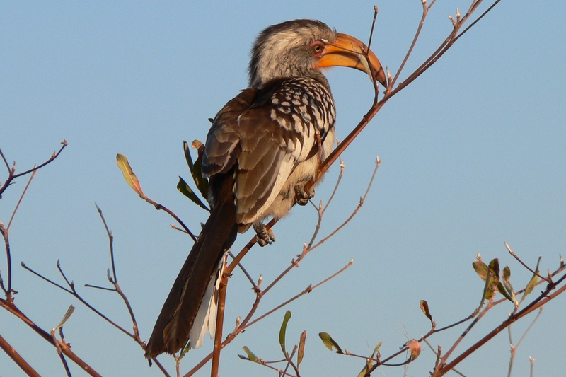 Yellow Hornbill (aka Flying Banana)
 Moon rising at Savute
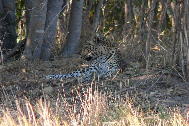 Leopard

Wildebeast at watering hole
Here are a few of the photos we took at Savute Elephant Camp. Yes, you can get that close to all the animals. They are NOT tame, but they have no fear of people as long as you don't make any sudden movements or noises.
Impala Male Three male lions - brothers Yellow Hornbill (aka Flying Banana) Moon rising at Savute LeopardWildebeast at watering hole
Sunday, July 09, 2006
Savute Elephant Camp
This place is not to be believed. Here we are out in the middle of nowhere, actually in the midst of the Savute (Dry) Marsh which is part of Chobe National Park in Botswana, and we are staying in this luxurious safari camp run by the Orient-Express people. The camp has a maximum capacity of 24 people and the staff outnumber the guests.
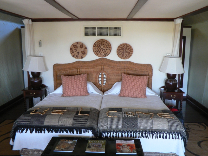
There are twelve "rooms" that they call tents, but these are the plushest tents I've ever seen. They are very comfortable bungalows that happen to have heavy tent-like walls and roof.
The food is to die for (not to die from) - they have a great South African chef who plans the menus for all three O-E camps in Botswana and then instructs the local people on how to prepare and serve the meals. Every single food item has to be shipped in - the non-perishables by truck from South Africa and the perishables by truck and plane from Maun, Botswana. It's an amazing logistical problem, but you never realize the extent of it when you're eating ostrich steak, kudu stew, or amarula mousse. The food preparation and presentation is equal to any Michelin two-three star restaurant.
There is NO way not to gain weight on this trip. We have a light breakfast before heading out on a morning game drive at around sunrise. We come back to camp around 10:30, and at 11:00 sit down for a full brunch. Then it's "siesta" time until High Tea at 3:00. At 3:30 we head out for another 3-4 hour game drive before sitting down for a huge dinner (preceeded by drinks of course) at 8:00. To top off the meal service, we stop about 3/4 of the way into the morning game drive for coffee, tea, and snacks, and during the afternoon drive for "sundowners". We got to like living in this style. Going back to (only) three meals a day will be tough to deal with.
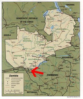
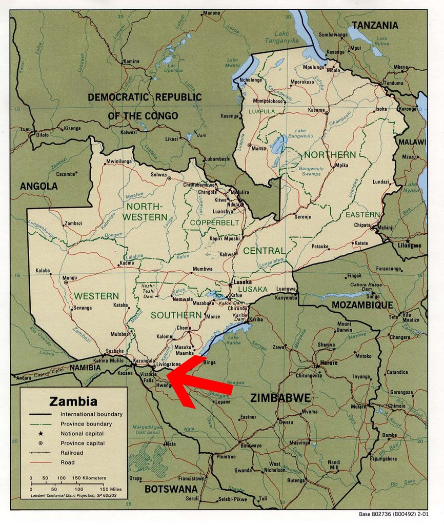
Getting here was a real experience. First, we drove in a van for an hour from Livingstone, Zambia to Kazangula (the border village where Zambia, Namibia, Botswana, and Zimbabwe all meet). It was actually a well paved road (one of the few in Zambia). The van broke down about half way there due to too much water in the diesel fuel - it's a common occurrence since the petrol stations water down the fuel to make more money selling it. Fortunately, our driver knew how to flush out the fuel line and we were off after a 10 minute delay.
At Kazangula, we got on a ferry boat to cross the Zambezi River and enter Botswana. They don't want to build a bridge, because everyone thinks riding a ferry is more fun. No one cares much for doing things quickly here - enjoying the experience is more important.
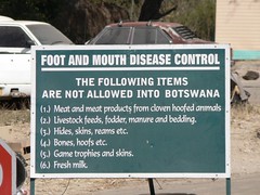
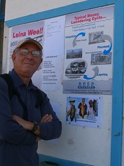
Exiting Zambia was quite quick (they stamp your passport). Entering Botswana was another story - you wait in an immigration line to get your passport stamped, then you have to walk across a damp rug to kill any germs on your shoes because they don't want hoof and mouth disease entering the country. (As if it's not already here.) It's a total joke. The office is plastered with posters warning people about money laundering, using condoms (they are free for the taking from a wall dispenser), and smuggling. All this in a country the size of France with a population of about 1.5 million people.
Then we drove to the airport in Kasane and boarded our 15 passenger Cessna. No flight attendant, no tickets, no meal or beverage service. The pilot walks thru the terminal and finds the people on his flight list. He ushers you thru their version of TSA security and you walk across the tarmac to the plane. 40 minutes later after flying at 4,500 feet and not hearing anything above the roar of the engine, we land at this dirt airstrip and we're picked up by the Orient-Express guides. Then it's another 15-20 minutes on a sand road to get to the camp.
I was right - no internet, no telephone, no television. But everyone on the staff introduces themselves on a first name basis and they make you feel totally at home. Why not? They want you to enjoy what they get to experience every day in this paradise - zillions of animals throughout a huge semi-arid dry marsh area, clean air, fantastic sunsets, and night skies loaded with stars (and a full moon during our stay).
This place is not to be believed. Here we are out in the middle of nowhere, actually in the midst of the Savute (Dry) Marsh which is part of Chobe National Park in Botswana, and we are staying in this luxurious safari camp run by the Orient-Express people. The camp has a maximum capacity of 24 people and the staff outnumber the guests.
There are twelve "rooms" that they call tents, but these are the plushest tents I've ever seen. They are very comfortable bungalows that happen to have heavy tent-like walls and roof.
The food is to die for (not to die from) - they have a great South African chef who plans the menus for all three O-E camps in Botswana and then instructs the local people on how to prepare and serve the meals. Every single food item has to be shipped in - the non-perishables by truck from South Africa and the perishables by truck and plane from Maun, Botswana. It's an amazing logistical problem, but you never realize the extent of it when you're eating ostrich steak, kudu stew, or amarula mousse. The food preparation and presentation is equal to any Michelin two-three star restaurant.
There is NO way not to gain weight on this trip. We have a light breakfast before heading out on a morning game drive at around sunrise. We come back to camp around 10:30, and at 11:00 sit down for a full brunch. Then it's "siesta" time until High Tea at 3:00. At 3:30 we head out for another 3-4 hour game drive before sitting down for a huge dinner (preceeded by drinks of course) at 8:00. To top off the meal service, we stop about 3/4 of the way into the morning game drive for coffee, tea, and snacks, and during the afternoon drive for "sundowners". We got to like living in this style. Going back to (only) three meals a day will be tough to deal with.
Getting here was a real experience. First, we drove in a van for an hour from Livingstone, Zambia to Kazangula (the border village where Zambia, Namibia, Botswana, and Zimbabwe all meet). It was actually a well paved road (one of the few in Zambia). The van broke down about half way there due to too much water in the diesel fuel - it's a common occurrence since the petrol stations water down the fuel to make more money selling it. Fortunately, our driver knew how to flush out the fuel line and we were off after a 10 minute delay.
At Kazangula, we got on a ferry boat to cross the Zambezi River and enter Botswana. They don't want to build a bridge, because everyone thinks riding a ferry is more fun. No one cares much for doing things quickly here - enjoying the experience is more important.
Exiting Zambia was quite quick (they stamp your passport). Entering Botswana was another story - you wait in an immigration line to get your passport stamped, then you have to walk across a damp rug to kill any germs on your shoes because they don't want hoof and mouth disease entering the country. (As if it's not already here.) It's a total joke. The office is plastered with posters warning people about money laundering, using condoms (they are free for the taking from a wall dispenser), and smuggling. All this in a country the size of France with a population of about 1.5 million people.
Then we drove to the airport in Kasane and boarded our 15 passenger Cessna. No flight attendant, no tickets, no meal or beverage service. The pilot walks thru the terminal and finds the people on his flight list. He ushers you thru their version of TSA security and you walk across the tarmac to the plane. 40 minutes later after flying at 4,500 feet and not hearing anything above the roar of the engine, we land at this dirt airstrip and we're picked up by the Orient-Express guides. Then it's another 15-20 minutes on a sand road to get to the camp.
I was right - no internet, no telephone, no television. But everyone on the staff introduces themselves on a first name basis and they make you feel totally at home. Why not? They want you to enjoy what they get to experience every day in this paradise - zillions of animals throughout a huge semi-arid dry marsh area, clean air, fantastic sunsets, and night skies loaded with stars (and a full moon during our stay).
Saturday, July 08, 2006
Forget Internet Access - Will We Even Have Phone Service?
Now I know we won't have internet access for several days. If we do, I'll be floored.
I suspect we won't even have phone service for several days. Talk about being out of touch with the outside world? Caren is having "CNN withdrawal pains". We haven't even seen a newspaper since we left South Africa.
We're heading to Botswana - the first stage by land to cross the border with Zambia, then by ferry to cross the Zambezi River just below its merger with the Chobe River, then by light plane (and I mean light) to one of the Orient-Express safari camps - Savute Elephant Camp. We're headed to the elephant capital of the world - Chobe National Park in Botswana. This should be great fun.
Then we go to a totally different type of safari camp, not far away and also in Botswana - Eagle Island. It is located in the Okavango Delta, which is fed by rivers from the Angolan Highlands that eventually flow into the Kalahari Desert. This is prime viewing country for hippos and birds.
I just hope we have enough memory cards for our digital cameras. This is no time to have to get stingy on taking photos.
Then again, do I really want to have to edit thousands of digital pictures to pick out "THE BEST" shots? Tough decision.
Friday, July 07, 2006
Visiting a Local Village
Most tourists to Victoria Falls stay at one of the "western style" hotels and never venture out to see what the community looks like. So one morning, we visited a local village. The poverty in Africa really became evident. It's quite apparent why the work being done by Bono, the Bill and Melinda Gates Foundation, and the Clinton Foundation is so important.
 The village we visited is rather well off since the government paid them to take land for a nearby electric generating plant and the power lines. I'm certain that more remote villages are even more needy. The village does have a school that operates to a certain age level and a medical clinic that is staffed two days a week.
A major source of income for the villagers is a souvenir market they operate. A number of the villagers make baskets, wood carvings, and paintings to sell. We felt somewhat ashamed to bargain since the needs of the people were so great. On the other hand, they are so pushy at trying to sell us stuff, they actually alienate some tourists and hurt themselves in the process. This is one case where a "soft selling" technique and reasonable prices would net the villagers a lot more revenue.

Most tourists to Victoria Falls stay at one of the "western style" hotels and never venture out to see what the community looks like. So one morning, we visited a local village. The poverty in Africa really became evident. It's quite apparent why the work being done by Bono, the Bill and Melinda Gates Foundation, and the Clinton Foundation is so important.
The village we visited is rather well off since the government paid them to take land for a nearby electric generating plant and the power lines. I'm certain that more remote villages are even more needy. The village does have a school that operates to a certain age level and a medical clinic that is staffed two days a week.A major source of income for the villagers is a souvenir market they operate. A number of the villagers make baskets, wood carvings, and paintings to sell. We felt somewhat ashamed to bargain since the needs of the people were so great. On the other hand, they are so pushy at trying to sell us stuff, they actually alienate some tourists and hurt themselves in the process. This is one case where a "soft selling" technique and reasonable prices would net the villagers a lot more revenue.
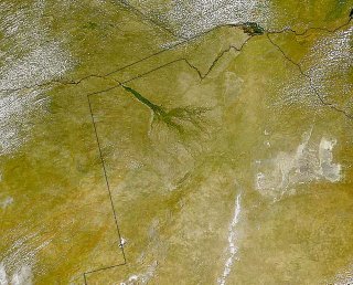
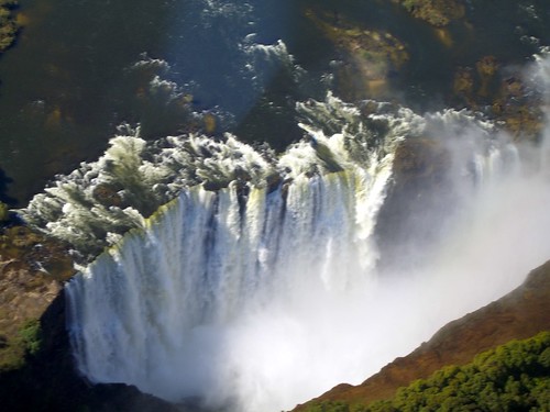
Satellite Images of Zambezi River Flowing Over Victoria Falls
First a history and geography lesson - Description of Victoria Falls from Wikipedia:
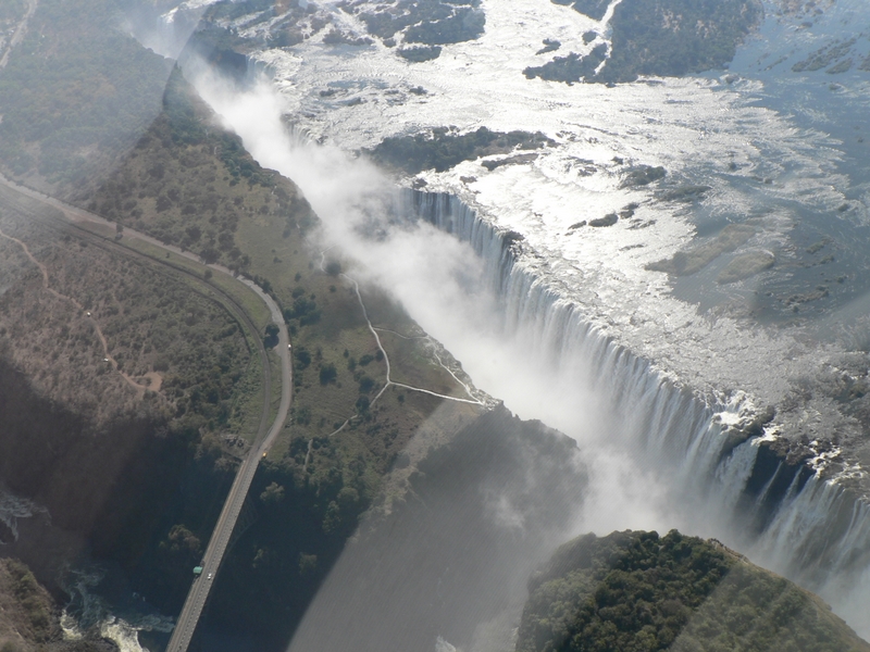
The Victoria Falls or Mosi-oa-Tunya are one of the world's most spectacular waterfalls. The falls are situated on the Zambezi River, on the border between Zambia and Zimbabwe, and are roughly 1.7 km (1 mile) wide and 128 m (420 ft) high. They are considered a remarkable spectacle because of the peculiar narrow slot-like chasm into which the water falls, so one can view the falls face-on.
David Livingstone, the Scottish explorer, visited the falls in 1855 and renamed them after Queen Victoria, though they were known locally as Mosi-oa-Tunya, the "smoke that thunders". The falls are part of two national parks, Mosi-oa-Tunya National Park in Zambia and Victoria Falls National Park in Zimbabwe, and are one of Southern Africa's major tourist attractions. They are also a UNESCO World Heritage Site.
Vastly larger than North America's Niagara Falls, Victoria is only rivalled by South America's Iguazu Falls (excluding large rapid like falls such as Livingston de Chutes). Iguazu and Victoria are generally regarded as the world's most spectacular waterfalls, with people divided as to which is the more impressive. Whilst Iguazu is divided into over 270 (relatively) 'small' falls and cataracts, Victoria is the largest single sheet of water in the world , over 100 meters tall in parts, and over one mile wide.
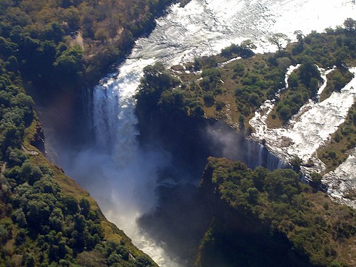
NASA Satellite image showing the broad Zambezi River falling into the narrow cleft and subsequent series of zigzagging gorges. Jordan did NOT take this picture. Click on the picture to see a larger image.
If you go to the following link you see an even more amazing sateliite image of Victoria Falls. Click on "View the Full Size Image". Our hotel is in the picture just above the falls and the swimming pool is visible. Space Imaging
First a history and geography lesson - Description of Victoria Falls from Wikipedia:
The Victoria Falls or Mosi-oa-Tunya are one of the world's most spectacular waterfalls. The falls are situated on the Zambezi River, on the border between Zambia and Zimbabwe, and are roughly 1.7 km (1 mile) wide and 128 m (420 ft) high. They are considered a remarkable spectacle because of the peculiar narrow slot-like chasm into which the water falls, so one can view the falls face-on.
David Livingstone, the Scottish explorer, visited the falls in 1855 and renamed them after Queen Victoria, though they were known locally as Mosi-oa-Tunya, the "smoke that thunders". The falls are part of two national parks, Mosi-oa-Tunya National Park in Zambia and Victoria Falls National Park in Zimbabwe, and are one of Southern Africa's major tourist attractions. They are also a UNESCO World Heritage Site.
Vastly larger than North America's Niagara Falls, Victoria is only rivalled by South America's Iguazu Falls (excluding large rapid like falls such as Livingston de Chutes). Iguazu and Victoria are generally regarded as the world's most spectacular waterfalls, with people divided as to which is the more impressive. Whilst Iguazu is divided into over 270 (relatively) 'small' falls and cataracts, Victoria is the largest single sheet of water in the world , over 100 meters tall in parts, and over one mile wide.

NASA Satellite image showing the broad Zambezi River falling into the narrow cleft and subsequent series of zigzagging gorges. Jordan did NOT take this picture. Click on the picture to see a larger image.
If you go to the following link you see an even more amazing sateliite image of Victoria Falls. Click on "View the Full Size Image". Our hotel is in the picture just above the falls and the swimming pool is visible. Space Imaging
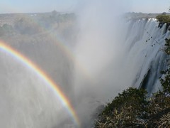

Will someone please jiggle the toilet handle?
We're outside of Livingstone, Zambia at Victoria Falls. Our hotel, the Zambezi Sun, is only a few steps away from the entrance to the falls. We can hear the falls all day and night. Sometimes you wish they'd shut it off for a while.
 We are on the Zambian side of the falls. This is right on the border with Zimbabwe - like the way Niagara Falls is shared by the U.S. and Canada. Most tourists stay here in Zambia because the accommodations are much better and the political situation in Zimbabwe has been dicey the past few years.
We'll post some pictures in the next blog post. Taking a tour of the falls in the morning and then we're taking a helicopter ride over the falls in the afternoon. Conditions permitting, I may be able to post some video clips of our heli ride.
Click this link for a
Satellite image of Zambezi River and Victoria Falls
Here's the weather at Victoria Falls. They only report the weather to international news services a couple of times a day, so the sticker below may show "data unavailable."
Thursday, July 06, 2006
Returned from the Bushveld
Jackalberry Safari Lodge was amazing. We took so many pictures and video.
Internet access was almost non-existent out in the bush. They only had a slow speed dial-up line. We didn't bother to use it.
This place was great. We went out on a game drive every morning at 6:15AM and every afternoon at 3:30PM. The game drives lasted about 4 hours each. Our driver, Dave, and our tracker, Lawrence, were really good. We kidded Lawrence that he could track the animals based on the size, shape, and freshness of their droppings.
Caren told them that their tip would be based on how many animals we saw. So, we think they drove us around to see the same animals multiple times.
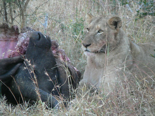
We saw the Big 5, minus one, the leopard. We saw elephants, lions (including them gnawing on a buffalo carcass they had killed), buffalo (not at all like our North American bison), and rhino (ugly devils).
 We rode in a totally open vehicle and were able to get within a few feet of all the animals. They couldn't care at all about us. To them, the vehicles aren't a threat and they leave them alone.
Now, we're outside of Johannesburg for one night before heading to Livingstone, Zambia and Victoria Falls - one of the seven natural wonders of the world.
Jackalberry Safari Lodge was amazing. We took so many pictures and video.
Internet access was almost non-existent out in the bush. They only had a slow speed dial-up line. We didn't bother to use it.
This place was great. We went out on a game drive every morning at 6:15AM and every afternoon at 3:30PM. The game drives lasted about 4 hours each. Our driver, Dave, and our tracker, Lawrence, were really good. We kidded Lawrence that he could track the animals based on the size, shape, and freshness of their droppings.
Caren told them that their tip would be based on how many animals we saw. So, we think they drove us around to see the same animals multiple times.
We saw the Big 5, minus one, the leopard. We saw elephants, lions (including them gnawing on a buffalo carcass they had killed), buffalo (not at all like our North American bison), and rhino (ugly devils).
We rode in a totally open vehicle and were able to get within a few feet of all the animals. They couldn't care at all about us. To them, the vehicles aren't a threat and they leave them alone.Now, we're outside of Johannesburg for one night before heading to Livingstone, Zambia and Victoria Falls - one of the seven natural wonders of the world.
Monday, July 03, 2006
Safari Time!
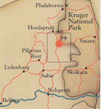
This morning we're off to Jackalberry Safari Lodge outside of Kruger National Park in the northeast part of South Africa. We fly from Cape Town to J'burg, change planes, and take a "puddle jumper" to Hoedspruit.
 We're not sure what kind of internet services exist where we're going, so we may go silent on you until we get back to J'burg in several days.
We're going to be at the foot of the Drakensburg Mountains, supposedly with some fantastic sunrises and sunsets in store for us (weather permitting). This time of year (winter) there is a good chance we'll see all the big animals as well as a lot of birds. The Jackalberry Lodge is located on one of the huge private game reserves outside of Kruger Park.
We don't want to hear any Tarzan and Jane jokes when you see pictures we post from the safari camps. This is NOT the African jungle, but the bushveld.
Touring Around Cape Town
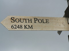
Well, the weather finally cleared a bit and we made it down Cape Point all the way to the Cape of Good Hope. This is the southwesternmost point on the African continent. Just when you think you're getting close to the South Pole, you see a sign at Cape Point that says we're still a LONG way off - 3,800 miles further.
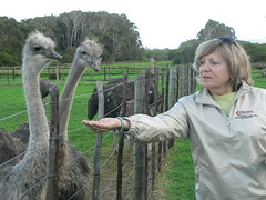
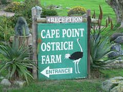
We stopped along the tour at an Ostrich Farm, and of course, Caren had to feed the animals. She wanted to take an ostrich home. She settled for a painted ostrich egg - another dustible for the living room.
Here is Caren at the Cape of Good Hope. The weather was blustery - about 5 minutes later it started to rain. We got some great shots from Cape Point, looking across False bay back towards Cape Town.

We also travelled to Stellenbosch - the heart of South African wine country. Coincidentally, we stopped at Jordan Winery. Of course, we had to have a tasting and buy a bottle. They gave us a glass with their logo on it. Will be an interesting conversation piece. This winery is not to be confused with the Jordan Winery in California - different owners, not related. When the SA winery imports into the U.S., they stick a different label on it "Jardin".
Stellenbosch is an old Dutch Cape city and the home of a large university. Lots of old houses kept as national landmarks from the Dutch era in the 1600s-1800s.
Well, the weather finally cleared a bit and we made it down Cape Point all the way to the Cape of Good Hope. This is the southwesternmost point on the African continent. Just when you think you're getting close to the South Pole, you see a sign at Cape Point that says we're still a LONG way off - 3,800 miles further.
We stopped along the tour at an Ostrich Farm, and of course, Caren had to feed the animals. She wanted to take an ostrich home. She settled for a painted ostrich egg - another dustible for the living room.
Here is Caren at the Cape of Good Hope. The weather was blustery - about 5 minutes later it started to rain. We got some great shots from Cape Point, looking across False bay back towards Cape Town.
We also travelled to Stellenbosch - the heart of South African wine country. Coincidentally, we stopped at Jordan Winery. Of course, we had to have a tasting and buy a bottle. They gave us a glass with their logo on it. Will be an interesting conversation piece. This winery is not to be confused with the Jordan Winery in California - different owners, not related. When the SA winery imports into the U.S., they stick a different label on it "Jardin".
Stellenbosch is an old Dutch Cape city and the home of a large university. Lots of old houses kept as national landmarks from the Dutch era in the 1600s-1800s.
Sunday, July 02, 2006
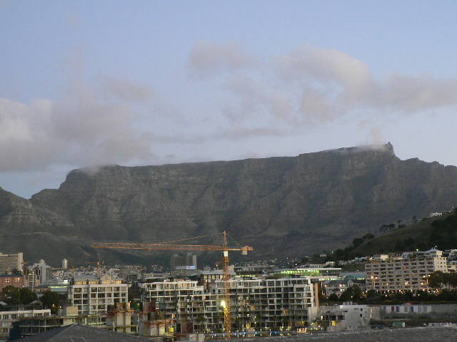
We've arrived in Cape Town
We FINALLY got to Cape Town last night. The flight from New York to Johannesburg made flights we've taken from LA to Sydney or LA to Hong Kong seem like "puddle jumpers." The overall flight time was 17 hours AND then we had a 3.5 hour layover before a two hour flight to Cape Town.
Today we took a half day tour of Cape Town. It was disappointing that the weather prevented us going to the top of Table Mountain. We'll try again tomorrow when the weather is supposed to improve.
Cape Town is very compact. We're staying at the waterfront which has been built up with lots of great shops, restaurants, and hotels. Going to sample seafood and Cape Malay cuisine tonight.
Subscribe to:
Posts (Atom)
